26th October 2019 - 23rd February 2020
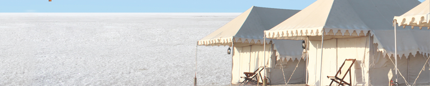
White Rann Resort - The Official Operator For Rann Utsav
Query Form HELPLINE NUMBER +91 8469 335 050
+91 8469 355 050

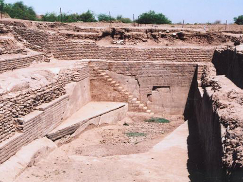
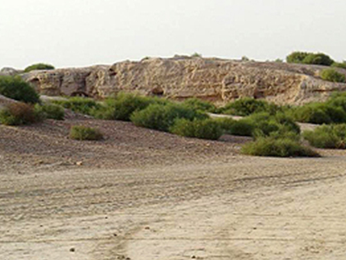
Dholavira
The archaeological excavations here have revealed an Indus Valley Civilisation site. It is one of the oldest and largest Indus sites in India. It is located on Khadir Island surrounded on all sides by the Great Rann of Kutch. It is important tourist place in kutch. Its must visit place at kutch.
An ancient city, and locally known as Kotada Timba Prachin Mahanagar Dholavira, is one of the largest and most prominent archaeological sites in India, belonging to the Indus Valley Civilization. It is located on the Khadir bet an island in the Kutch Desert Wildlife Sanctuary, Great Rann of Kutch. The site is surrounded by water in the monsoon season The site was occupied from c.2650 BC, declining slowly after about 2100 BCE. It was briefly abandoned and reoccupied until c.1450 BCE. The site was discovered in 1967-8 by J.P. Joshi and is the fifth largest Harappan site in the Indian subcontinent, and has been under excavation almost continuously since 1990 by Mr. Bist the director of the Archaeological Survey of India. Eight large urban centers have been discovered: Harappa, Mohenjo Daro, Ganeriwala, Rakhigarhi, Kalibangan, Rupar, Dholavira, and Lothal. Dholavira is the only site where the SIGN BOARD – INSCRIPTION of TEN LETTERS found during excavations . Also a large STADIUM re excavated . This city has 16 reservoirs for WATER and most of are inter connect by under ground canals . Also a dam on river!!
A series of excavations by the Archeological proved that Dholavira ranks, with Mohenjo Daro, Harappa, Ganweriwal now all in Pakistan and Rakhigari in India, was one among 5 largest urban centres of the Harappan civilization. Surveys of India uncovered Dholavira as a major exquisitely planned Harappan city. It had monumental structures, aesthetic architecture and an amazing water management system. The ancient ruins of Dholavira spread over about 100 ha nearly half of which is a fortified settlement. Dholavira was laid out on sloping terrain between to storm water channels, Mansar in the north and Mahar in the south. The city was enclosed by a massive wall, designed like a large parallelogram measuring 771 metres in length and 616 metres in width. It is evident that the site of the settlement was picked after good deal of forethought and planning. The gradient, between the higher east and the lower west of Dholavira is 13 metres, which is ideal location for reservoirs. In fact, along the inside of the city's walls is a series of water reservoirs, which almost entirely surround the 3 principal divisions of the city, designated Citadel, the Middle Town and the Lower Town. The citadel which stand majestically on the south side consists of 2 fortified divisions on the east and west named castle and Bailey respectively The Middle town, also fortified, lies to the north and is separated from the citadel by a long and wide ceremonial ground. To the east of Middle town is the lower Town, which is not fortified. Dholavira also enjoys the unique distinction of yielding the word's oldest signboard, comprising an inscription of 10 large sited alphabets of the Harappan script. Plenty of stones were available at Dholavira and were used to make tiles for the water system drains and channels. Pottery pipes were also used. In some places mortar was made of superfine sticky grey clay.
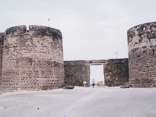
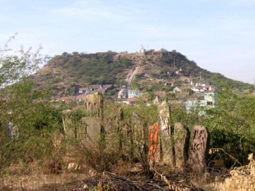
Lakhpat Fort
Lakhpat has religious significance for three of India's most populous religions: Guru Nanak, the founder of Sikhism, reportedly camped here on his journey to Mecca. The site later became a gurudwara, which holds some of Nanak's possessions; Pir Ghaus Muhammed, a Sufi mystic who from the age of twelve devoted himself to spiritual practice and reportedly practiced half as a Hindu and half as a Muslim, is buried here in Lakhpat. His tomb is a stone construction with very complex carvings and a water tank that is said to have healing properties for skin problems; Sayyed Pir Shah's nine-domed mausoleum has intricate carvings, doors, windows and jaalis.
Now, the Border Security Force outposts keep a diligent vigil over the area as there a few kilometers away is the international border of India with Pakistan from where smugglers and insurgents try to sneak into India every now and then. It is a delight to see the Chinkara and the Nilgai. One has to be very lucky to spot the caracal or the civet. The sight of peacocks and the call of the partridges follow one right up to the fort of Lakhpat
In Lakhpat Fort Town, there is a gurudwara that attracts the tourists. The name of Gurudwara is the Lakhpat Gurudwara Sahib, religious place for the Sikhs. Even today, Guru Nanak's footwear and the palkhi are worshiped by the Udasi Sect. The Gurudwara is declared a protected monument by the Archeological Department and has won the UNESCO award for restoration after the Bhuj earthquake. The Hindi film, J.P Dutta's Refugee is shot on location in the Great Rann of Kutch and other locations in the Kutch district of Gujarat.
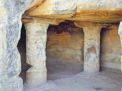
Siyot Caves
Dated around the first century AD, Siyot Caves have an east facing sanctum and an ambulatory. Siyot must have been on of the 80 monastic sites that the 7th century Chinese travellers reported at the mouth of Indus River. These caves have their origin to the first century AD. It is also worth knowing that the caves have Sanctum and an ambulatory which are east facing. Really, this place presents a picture of traditional culture and illustrious history. The traces describe that Siyot Caves at the mouth of the Indus River, were one of the 80 monastic sites for Chinese Pilgrims.
The inscriptions and architectures of the ancient times attract people for visiting these caves. Sculptures of this place are centre of attraction for the tourists. The cave’s artistic carvings are included in the uncommon things which have been traced across the nation. As a result, this place has turned out as a very unique, soulful and interesting place for visiting. If we talk about its archaeological aspect, it leaves a beautiful picture in mind. This place also had a very strong Buddhist link which is clearly revealed by the sanctum and the ambulant.
It is really commendable at Government of Gujarat’s part that it takes proper measures and makes full proof programs to preserve this Buddhist cave
Surkotada
The site at Surkotada is located 160 km north-east of Bhuj, in the district of Kutch, Gujarat. The ancient mound stands surrounded by an undulating rising ground clustered by small sandstone hills. These hills are covered with red laterite soil giving the entire region a reddish brown colour. The vegetation is scarce and consists of cactus, small babul and pilu trees and thorny shrubs. These give green patches to the red environment. The mound was discovered in 1964 by Shri Jagat Pati Joshi of the Archaeological Survey of India. The mound is higher on the western side and lower on the eastern side and has an average height of 5 to 8 m (16-26 ft). In the ancient days, a river 750 m (½ mi) wide flowed past the north-eastern side of the site. This river, which emptied into the Little Rann, might have been an important reason for siting the town here. Now this river is only a small nalla (stream).
Kanmer
(Bakarkot), a multicultural site, is located in Rapar tehsil of Kachchh district of Gujarat, India. Our controlled excavations have yielded five-stage cultural sequence at the site. Period I (i.e. Kanmer I) was marked by coarse and fine varieties of Red Ware, the latter often painted in bichrome. The characteristic Anarta material of course appears in the upper levels of this brown sandy clay deposit. Kanmer II (or Period II) is characterized by residential structures and a strong fortification associated with the Harappan material similar to the urban phase of Dholavira.
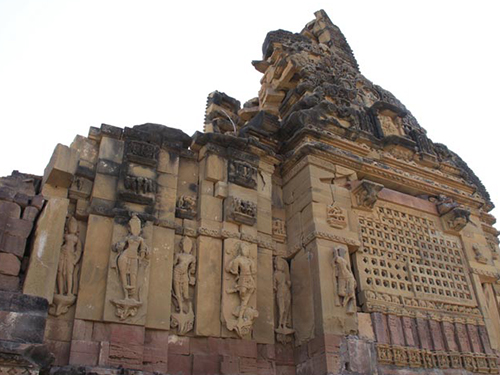
Kera Shiva Temple
Just 22 kms south of Bhuj on the road to Mandra, Kera houses the ruins of a Shiva Temple that dates to the era of the Solanki rulers. Only part of the temple remains, as much was destroyed in the 1819 earthquake, but the inner sanctum is still there, as well as half of the main spire. The Fort of Kapilkot, also in a rather rundown state, is next to the temple.
Shiva Temple, Kera, Kutch, Gujarat: Kera is renowned for its 10th century Shiva Temple. The present day ruins are suggestive of how beautiful the temple must have been centuries ago. Sadly, the temple was damaged in the epoch-making earthquake of 1819AD. Very near to this ruined Shiva temple, is a Muslim shrine of Ghulam Ali Shah. The annual Urs held here attracts devotees from all faiths. Earnest worshippers walking on smoldering coal is the prime attraction of kutch tour.
Kutchrannutsavonline.com A unit of AtoZ Holidays
A-305, Mondeal Heights, Near Wide Angle Cinema, S.G.Highway, Ahmedabad, Gujarat 380015
HELPLINE NUMBER +91 8469 335 050
+91 8469 355 050